
New London County topographic map
Interactive map
Click on the map to display elevation.
About this map
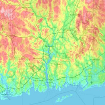
Name: New London County topographic map, elevation, terrain.
Average elevation: 73 m
Minimum elevation: -3 m
Maximum elevation: 239 m
Other topographic maps
Click on a map to view its topography, its elevation and its terrain.
Blue Lake Dam
Estados Unidos de América > Connecticut > Southeastern Connecticut Planning Region > North Stonington
Blue Lake Dam, North Stonington, Southeastern Connecticut Planning Region, Connecticut, Estados Unidos de América
Average elevation: 108 m