
Thank you for supporting this site ❤️
Make a donation
Make a donation
Golden Eagle topographic map
Click on the map to display elevation.
Thank you for supporting this site ❤️
Make a donation
Make a donation
About this map
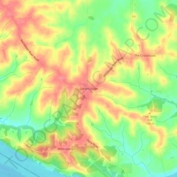
Name: Golden Eagle topographic map, elevation, terrain.
Location: Golden Eagle, Calhoun County, Illinois, 62036, United States (38.87338 -90.59901 38.91338 -90.55901)
Average elevation: 170 m
Minimum elevation: 129 m
Maximum elevation: 206 m
Thank you for supporting this site ❤️
Make a donation
Make a donation
Other topographic maps
Click on a map to view its topography, its elevation and its terrain.