
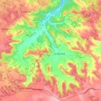
Le Boulvé topographic map
Interactive map
Click on the map to display elevation.
About this map
Name: Le Boulvé topographic map, elevation, terrain.
Average elevation: 216 m
Minimum elevation: 112 m
Maximum elevation: 296 m
La superficie de la commune est de 1 951 hectares ; son altitude varie de 108 à 292 mètres.
Other topographic maps
Click on a map to view its topography, its elevation and its terrain.
Fargues
France > Occitanie > Lot > Porte-du-Quercy
Fargues, Porte-du-Quercy, Cahors, Lot, Occitanie, France métropolitaine, 46800, France
Average elevation: 238 m
Saux
France > Occitanie > Lot > Porte-du-Quercy
Saux, Porte-du-Quercy, Cahors, Lot, Occitanie, France métropolitaine, 46800, France
Average elevation: 239 m