
东岗镇 topographic map
Interactive map
Click on the map to display elevation.
About this map
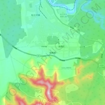
Name: 东岗镇 topographic map, elevation, terrain.
Location: 东岗镇, 抚松县, 白山市, 吉林省, 134504, 中国 (42.10398 127.45536 42.18398 127.53536)
Average elevation: 795 m
Minimum elevation: 682 m
Maximum elevation: 1,093 m
Other topographic maps
Click on a map to view its topography, its elevation and its terrain.