
Thank you for supporting this site ❤️
Make a donation
Make a donation
Hạ Long topographic map
Click on the map to display elevation.
Thank you for supporting this site ❤️
Make a donation
Make a donation
About this map
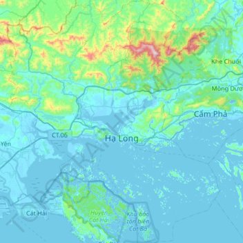
Name: Hạ Long topographic map, elevation, terrain.
Location: Hạ Long, Phường Tuần Châu, Quảng Ninh Province, Vietnam (20.68689 106.82556 21.23899 107.34692)
Average elevation: 89 m
Minimum elevation: -9 m
Maximum elevation: 1,030 m
Thank you for supporting this site ❤️
Make a donation
Make a donation