
Thank you for supporting this site ❤️
Make a donation
Make a donation
Helchteren topographic map
Click on the map to display elevation.
Thank you for supporting this site ❤️
Make a donation
Make a donation
About this map
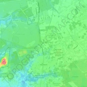
Name: Helchteren topographic map, elevation, terrain.
Location: Helchteren, Houthalen-Helchteren, Maaseik, Limbourg, Belgique (51.04455 5.33937 51.10402 5.45441)
Average elevation: 68 m
Minimum elevation: 41 m
Maximum elevation: 142 m
Thank you for supporting this site ❤️
Make a donation
Make a donation