
La Bâtie topographic map
Interactive map
Click on the map to display elevation.
About this map
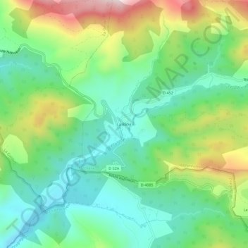
Name: La Bâtie topographic map, elevation, terrain.
Average elevation: 1,071 m
Minimum elevation: 897 m
Maximum elevation: 1,419 m
Other topographic maps
Click on a map to view its topography, its elevation and its terrain.
La Foux
France > Provence-Alpes-Côte d'Azur > Alpes-de-Haute-Provence > Peyroules
La Foux, Peyroules, Castellane, Alpes-de-Haute-Provence, Provence-Alpes-Côte d'Azur, France métropolitaine, 04120, France
Average elevation: 1,280 m
Le Mousteiret
France > Provence-Alpes-Côte d'Azur > Alpes-de-Haute-Provence > Peyroules
Le Mousteiret, Peyroules, Castellane, Alpes-de-Haute-Provence, Provence-Alpes-Côte d'Azur, France métropolitaine, 04120, France
Average elevation: 1,085 m