
Leighton topographic map
Interactive map
Click on the map to display elevation.
About this map
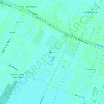
Name: Leighton topographic map, elevation, terrain.
Location: Leighton, Lafourche Parish, Louisiana, 70301, United States (29.77660 -90.87787 29.81660 -90.83787)
Average elevation: 3 m
Minimum elevation: -1 m
Maximum elevation: 6 m
Other topographic maps
Click on a map to view its topography, its elevation and its terrain.
Port Fourchon
United States > Louisiana > Lafourche Parish
Port Fourchon, Lafourche Parish, Louisiana, United States
Average elevation: 1 m
Beaujolais
United States > Louisiana > Lafourche Parish
Beaujolais, Lafourche Parish, Louisiana, 70310, United States
Average elevation: 3 m
Golden Meadow
United States > Louisiana > Lafourche Parish
Golden Meadow, Lafourche Parish, Louisiana, United States
Average elevation: 1 m
Thibodaux
United States > Louisiana > Lafourche Parish > Thibodaux
Thibodaux, Lafourche Parish, Louisiana, 70301, United States
Average elevation: 3 m
Thibodaux
United States > Louisiana > Lafourche Parish
Thibodaux, Lafourche Parish, Louisiana, United States
Average elevation: 3 m