
Imigrantes topographic map
Interactive map
Click on the map to display elevation.
About this map
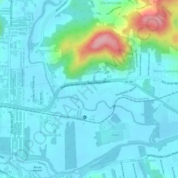
Name: Imigrantes topographic map, elevation, terrain.
Average elevation: 44 m
Minimum elevation: 13 m
Maximum elevation: 188 m
Other topographic maps
Click on a map to view its topography, its elevation and its terrain.
Quati
Brasil > Santa Catarina > Guaramirim
Quati, Guaramirim, Região Geográfica Imediata de Joinville, Santa Catarina, Região Sul, Brasil
Average elevation: 16 m