
花庄镇 topographic map
Interactive map
Click on the map to display elevation.
About this map
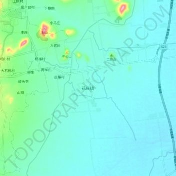
Name: 花庄镇 topographic map, elevation, terrain.
Location: 花庄镇, 驻马店市, 河南省, 中国 (33.07605 113.74012 33.15605 113.82012)
Average elevation: 94 m
Minimum elevation: 71 m
Maximum elevation: 233 m
Other topographic maps
Click on a map to view its topography, its elevation and its terrain.