
Britsum topographic map
Interactive map
Click on the map to display elevation.
About this map
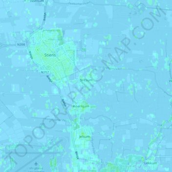
Name: Britsum topographic map, elevation, terrain.
Location: Britsum, Leeuwarden, Friesland, Niederlande (53.24375 5.73598 53.25720 5.83031)
Average elevation: 0 m
Minimum elevation: -3 m
Maximum elevation: 4 m
Other topographic maps
Click on a map to view its topography, its elevation and its terrain.
Weidum
Niederlande > Friesland > Leeuwarden
Weidum, Leeuwarden, Friesland, Niederlande
Average elevation: 0 m
Jellum
Niederlande > Friesland > Leeuwarden
Jellum, Leeuwarden, Friesland, Niederlande
Average elevation: 0 m
Bears
Niederlande > Friesland > Leeuwarden
Bears, Leeuwarden, Friesland, Niederlande
Average elevation: 0 m
Goutum
Niederlande > Friesland > Leeuwarden
Goutum, Leeuwarden, Friesland, Niederlande
Average elevation: 1 m
Hilaard
Niederlande > Friesland > Leeuwarden
Hilaard, Leeuwarden, Friesland, Niederlande
Average elevation: 0 m
Miedum
Niederlande > Friesland > Leeuwarden
Miedum, Leeuwarden, Friesland, Niederlande
Average elevation: 0 m
Lekkum
Niederlande > Friesland > Leeuwarden
Lekkum, Leeuwarden, Friesland, Niederlande
Average elevation: 0 m
Warstiens
Niederlande > Friesland > Leeuwarden
Warstiens, Leeuwarden, Friesland, Niederlande
Average elevation: -1 m
Húns
Niederlande > Friesland > Leeuwarden
Húns, Leeuwarden, Friesland, Niederlande
Average elevation: 0 m
Eagum
Niederlande > Friesland > Leeuwarden
Eagum, Leeuwarden, Friesland, Niederlande
Average elevation: 0 m
Hijum
Niederlande > Friesland > Leeuwarden
Hijum, Leeuwarden, Friesland, Niederlande
Average elevation: -1 m
Swichum
Niederlande > Friesland > Leeuwarden
Swichum, Leeuwarden, Friesland, Niederlande
Average elevation: 0 m