
Matabeleland North Province topographic map
Interactive map
Click on the map to display elevation.
About this map
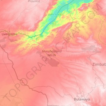
Name: Matabeleland North Province topographic map, elevation, terrain.
Location: Matabeleland North Province, Zimbabwe (-20.35534 25.23730 -16.86604 29.23332)
Average elevation: 1,014 m
Minimum elevation: 481 m
Maximum elevation: 1,553 m
Other topographic maps
Click on a map to view its topography, its elevation and its terrain.