
Kekaha topographic map
Interactive map
Click on the map to display elevation.
About this map
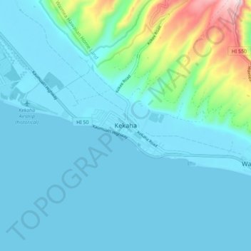
Name: Kekaha topographic map, elevation, terrain.
Location: Kekaha, Kauaʻi County, Hawaii, 96752, United States (21.93083 -159.75500 22.01083 -159.67500)
Average elevation: 69 m
Minimum elevation: 0 m
Maximum elevation: 517 m