
Thank you for supporting this site ❤️
Make a donation
Make a donation
Bernhardswinden topographic map
Click on the map to display elevation.
Thank you for supporting this site ❤️
Make a donation
Make a donation
Bernhardswinden
Gottfried Stieber beschrieb den Ort in seinem 1761 erschienenen Werk „Historische und topographische Nachrichten von dem Fürstenthum Brandenburg-Onolzbach“ folgendermaßen.
Thank you for supporting this site ❤️
Make a donation
Make a donation
About this map
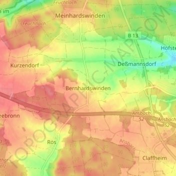
Name: Bernhardswinden topographic map, elevation, terrain.
Location: Bernhardswinden, Ansbach, Bayern, 91522, Deutschland (49.24398 10.54630 49.28398 10.58630)
Average elevation: 471 m
Minimum elevation: 422 m
Maximum elevation: 500 m
Thank you for supporting this site ❤️
Make a donation
Make a donation