
Santa Lucía topographic map
Interactive map
Click on the map to display elevation.
About this map
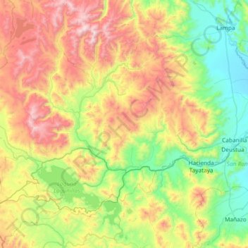
Name: Santa Lucía topographic map, elevation, terrain.
Location: Santa Lucía, Lampa, Puno, Perú (-15.85125 -71.03897 -15.31665 -70.45260)
Average elevation: 4,404 m
Minimum elevation: 3,838 m
Maximum elevation: 5,431 m