Geolocate

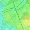
Hexenturm topographic map

Click on the map to display elevation.

About this map

Name: Hexenturm topographic map, elevation, terrain.

Location: Hexenturm, Garbsener Landstraße, Marienwerder, Herrenhausen, Hanover, Region Hannover, Lower Saxony, 30419, Germany (52.40975 9.63371 52.40980 9.63379)

Average elevation: 51 m

Minimum elevation: 43 m

Maximum elevation: 60 m

Other topographic maps

Click on a map to view its topography, its elevation and its terrain.
30519

Germany > Lower Saxony > Region Hannover > Hanover

Average elevation: 61 m

30165

Germany > Lower Saxony > Region Hannover > Hanover

Average elevation: 56 m