
Chersonisos topographic map
Interactive map
Click on the map to display elevation.
About this map
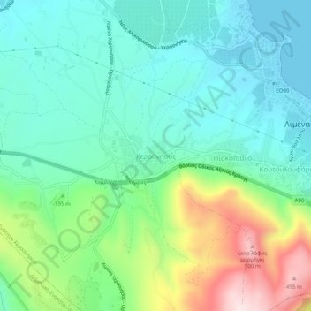
Name: Chersonisos topographic map, elevation, terrain.
Average elevation: 149 m
Minimum elevation: 0 m
Maximum elevation: 539 m
Other topographic maps
Click on a map to view its topography, its elevation and its terrain.
Anissaras
Griechenland > Region Kreta > Regionalbezirk Iraklio > Δημοτική Ενότητα Χερσονήσου
Anissaras, Gemeinde Limin Chersonisou, Δημοτική Ενότητα Χερσονήσου, Provinz Chersonissos, Regionalbezirk Iraklio, Region Kreta, 700 14, Griechenland
Average elevation: 16 m