
Thank you for supporting this site ❤️
Make a donation
Make a donation
Eureka topographic map
Click on the map to display elevation.
Thank you for supporting this site ❤️
Make a donation
Make a donation
About this map
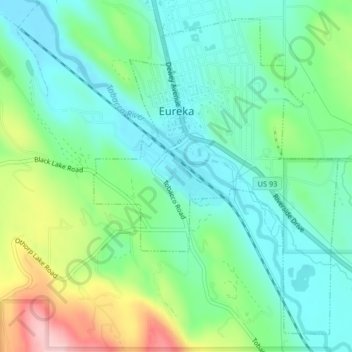
Name: Eureka topographic map, elevation, terrain.
Location: Eureka, Lincoln County, Montana, United States (48.86286 -115.06314 48.88706 -115.03452)
Average elevation: 832 m
Minimum elevation: 775 m
Maximum elevation: 968 m
Thank you for supporting this site ❤️
Make a donation
Make a donation
Other topographic maps
Click on a map to view its topography, its elevation and its terrain.
Kootenai River
United States > Montana > Lincoln County
Comparisons of various U.S. Geological Survey (USGS) topographic maps from the 20th century show many misinterpretations or alternative names being applied to the segment of the river within the United States. These include "Kootanie", "Kootenie", and "Kootienay". The Geographic Names Information System of the…
Average elevation: 864 m
Thank you for supporting this site ❤️
Make a donation
Make a donation
Thank you for supporting this site ❤️
Make a donation
Make a donation