
砚台镇 topographic map
Interactive map
Click on the map to display elevation.
About this map
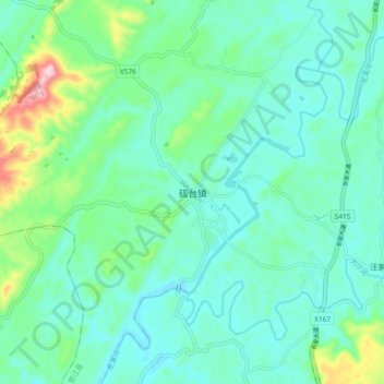
Name: 砚台镇 topographic map, elevation, terrain.
Location: 砚台镇, 垫江县, 重庆市, 中国 (30.10750 107.28000 30.18750 107.36000)
Average elevation: 405 m
Minimum elevation: 349 m
Maximum elevation: 618 m
Other topographic maps
Click on a map to view its topography, its elevation and its terrain.