
Thank you for supporting this site ❤️
Make a donation
Make a donation
Venegono Superiore topographic map
Click on the map to display elevation.
Thank you for supporting this site ❤️
Make a donation
Make a donation
About this map
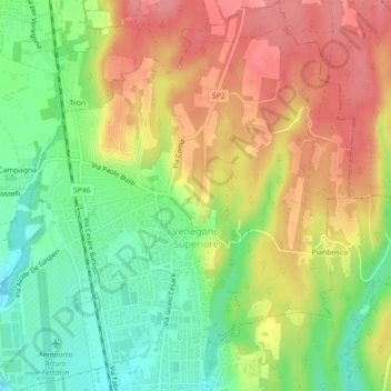
Name: Venegono Superiore topographic map, elevation, terrain.
Location: Venegono Superiore, Varese, Lombardy, Italy (45.73924 8.88015 45.77007 8.92264)
Average elevation: 362 m
Minimum elevation: 318 m
Maximum elevation: 404 m
Thank you for supporting this site ❤️
Make a donation
Make a donation
Other topographic maps
Click on a map to view its topography, its elevation and its terrain.