
Chippenham topographic map
Click on the map to display elevation.
About this map
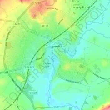
Name: Chippenham topographic map, elevation, terrain.
Location: Chippenham, Wiltshire, England, United Kingdom (51.43064 -2.15211 51.47922 -2.08142)
Average elevation: 63 m
Minimum elevation: 39 m
Maximum elevation: 118 m
Other topographic maps
Click on a map to view its topography, its elevation and its terrain.