
Thành phố Thuận An topographic map
Interactive map
Click on the map to display elevation.
About this map
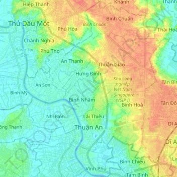
Name: Thành phố Thuận An topographic map, elevation, terrain.
Location: Thành phố Thuận An, Province de Bình Dương, Viêt Nam (10.86587 106.65020 10.99749 106.75336)
Average elevation: 15 m
Minimum elevation: -1 m
Maximum elevation: 41 m