
Chaumont topographic map
Interactive map
Click on the map to display elevation.
About this map
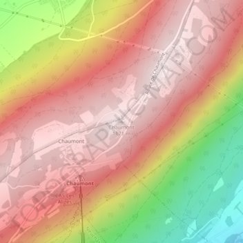
Name: Chaumont topographic map, elevation, terrain.
Location: Chaumont, Neuchâtel, 2067, Suisse (47.03260 6.96423 47.03270 6.96433)
Average elevation: 948 m
Minimum elevation: 516 m
Maximum elevation: 1,178 m
Other topographic maps
Click on a map to view its topography, its elevation and its terrain.
Corcelles-Cormondrèche
Suisse > Neuchâtel > Neuchâtel
Corcelles-Cormondrèche, Neuchâtel, 2035, Suisse
Average elevation: 617 m