
Rowland's Copse, Red Hill topographic map
Interactive map
Click on the map to display elevation.
About this map
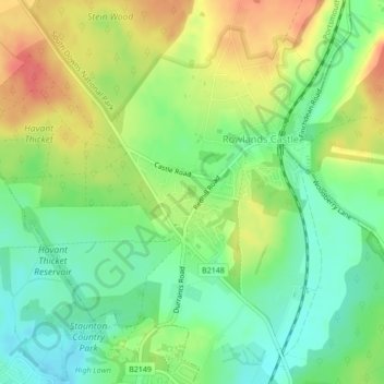
Name: Rowland's Copse, Red Hill topographic map, elevation, terrain.
Average elevation: 42 m
Minimum elevation: 16 m
Maximum elevation: 74 m
Other topographic maps
Click on a map to view its topography, its elevation and its terrain.
Havant Thicket
United Kingdom > England > Hampshire > East Hampshire > Rowlands Castle
Havant Thicket, Rowlands Castle, East Hampshire, Hampshire, England, United Kingdom
Average elevation: 48 m