
金牛镇 topographic map
Interactive map
Click on the map to display elevation.
About this map
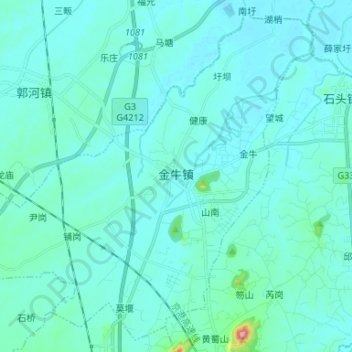
Name: 金牛镇 topographic map, elevation, terrain.
Location: 金牛镇, 庐江县, 合肥市, 安徽省, 231500, 中国 (31.34506 117.12306 31.45007 117.25502)
Average elevation: 20 m
Minimum elevation: 3 m
Maximum elevation: 193 m
Other topographic maps
Click on a map to view its topography, its elevation and its terrain.