
临高县 topographic map
Interactive map
Click on the map to display elevation.
About this map
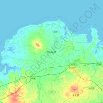
Name: 临高县 topographic map, elevation, terrain.
Location: 临高县, 海南省, 中国 (19.75026 109.52590 20.07026 109.84590)
Average elevation: 36 m
Minimum elevation: -2 m
Maximum elevation: 240 m
Other topographic maps
Click on a map to view its topography, its elevation and its terrain.