
Porsangerfjorden topographic map
Interactive map
Click on the map to display elevation.
About this map
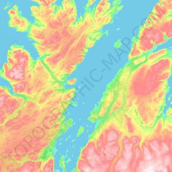
Name: Porsangerfjorden topographic map, elevation, terrain.
Location: Porsangerfjorden, Repvåg, Nordkapp, Troms og Finnmark, Norvège (70.06886 24.92386 70.89710 26.34659)
Average elevation: 225 m
Minimum elevation: -5 m
Maximum elevation: 795 m