
鄯善县 topographic map
Interactive map
Click on the map to display elevation.
About this map
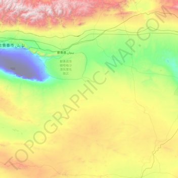
Name: 鄯善县 topographic map, elevation, terrain.
Location: 鄯善县, 吐鲁番市, Xinjiang, China (41.19750 89.39472 43.55290 91.91660)
Average elevation: 997 m
Minimum elevation: -154 m
Maximum elevation: 4,166 m