
Lonesome Lake topographic map
Interactive map
Click on the map to display elevation.
About this map
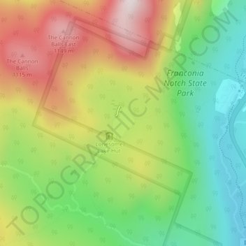
Name: Lonesome Lake topographic map, elevation, terrain.
Average elevation: 810 m
Minimum elevation: 506 m
Maximum elevation: 1,198 m
Other topographic maps
Click on a map to view its topography, its elevation and its terrain.
Mount Wolf
United States > New Hampshire > Grafton County > Lincoln
Mount Wolf, Lincoln, Grafton County, New Hampshire, United States
Average elevation: 827 m
The Village of Loon Mountain
United States > New Hampshire > Grafton County > Lincoln > The Village of Loon Mountain
The Village of Loon Mountain, Lincoln, Grafton County, New Hampshire, 03251, United States
Average elevation: 532 m