
Wittgenstein topographic map
Interactive map
Click on the map to display elevation.
About this map
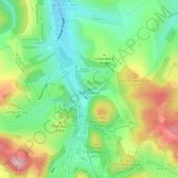
Name: Wittgenstein topographic map, elevation, terrain.
Average elevation: 333 m
Minimum elevation: 261 m
Maximum elevation: 444 m
Other topographic maps
Click on a map to view its topography, its elevation and its terrain.
Deubach
Deutschland > Thüringen > Wartburgkreis > Wutha-Farnroda > Deubach
Deubach, Wutha-Farnroda, Wartburgkreis, Thüringen, 99848, Deutschland
Average elevation: 339 m
Wutha-Farnroda
Deutschland > Thüringen > Wartburgkreis > Wutha-Farnroda
Wutha-Farnroda, Wartburgkreis, Thüringen, 99848, Deutschland
Average elevation: 351 m