
Le Moulin du Vey topographic map
Interactive map
Click on the map to display elevation.
About this map
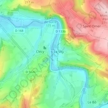
Name: Le Moulin du Vey topographic map, elevation, terrain.
Average elevation: 114 m
Minimum elevation: 30 m
Maximum elevation: 268 m
Other topographic maps
Click on a map to view its topography, its elevation and its terrain.
La Commune
France > Normandie > Calvados > Le Vey
La Commune, Le Vey, Caen, Calvados, Normandie, France métropolitaine, 14570, France
Average elevation: 161 m
Le Bas du Vey
France > Normandie > Calvados > Le Vey
Le Bas du Vey, Le Vey, Caen, Calvados, Normandie, France métropolitaine, 14570, France
Average elevation: 118 m