
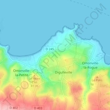
L'Alzart topographic map
Interactive map
Click on the map to display elevation.
About this map
Name: L'Alzart topographic map, elevation, terrain.
Average elevation: 37 m
Minimum elevation: -1 m
Maximum elevation: 143 m
Other topographic maps
Click on a map to view its topography, its elevation and its terrain.
Hameau ès Fours
France > Normandie > Manche > La Hague > Digulleville
Hameau ès Fours, Digulleville, La Hague, Cherbourg, Manche, Normandie, France métropolitaine, 50440, France
Average elevation: 50 m