
Thank you for supporting this site ❤️
Make a donation
Make a donation
Serra Morena topographic map
Click on the map to display elevation.
Thank you for supporting this site ❤️
Make a donation
Make a donation
About this map
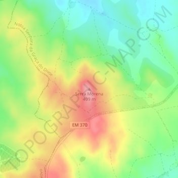
Name: Serra Morena topographic map, elevation, terrain.
Location: Serra Morena, Évora, Alentejo Central, Alentejo, Portugal (38.63115 -8.02771 38.63125 -8.02761)
Average elevation: 350 m
Minimum elevation: 300 m
Maximum elevation: 409 m
Thank you for supporting this site ❤️
Make a donation
Make a donation
Other topographic maps
Click on a map to view its topography, its elevation and its terrain.