
Stapley topographic map
Click on the map to display elevation.
About this map
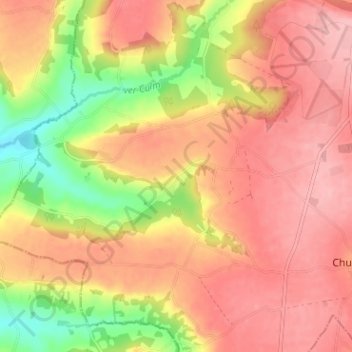
Name: Stapley topographic map, elevation, terrain.
Average elevation: 227 m
Minimum elevation: 149 m
Maximum elevation: 273 m
Other topographic maps
Click on a map to view its topography, its elevation and its terrain.
Brompton Ralph
United Kingdom > England > Somerset > Somerset West and Taunton
Average elevation: 224 m
Bishops Lydeard
United Kingdom > England > Somerset > Somerset West and Taunton > Bishops Lydeard
Average elevation: 60 m