
Thank you for supporting this site ❤️
Make a donation
Make a donation
Ojochuanan topographic map
Click on the map to display elevation.
Thank you for supporting this site ❤️
Make a donation
Make a donation
About this map
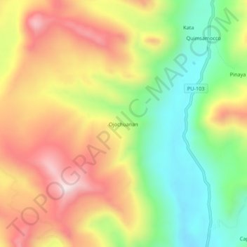
Name: Ojochuanan topographic map, elevation, terrain.
Location: Ojochuanan, Ajoyani, Province of Carabaya, Puno, Peru (-14.16988 -70.23677 -14.12988 -70.19677)
Average elevation: 4,679 m
Minimum elevation: 4,387 m
Maximum elevation: 4,997 m
Thank you for supporting this site ❤️
Make a donation
Make a donation