
Thank you for supporting this site ❤️
Make a donation
Make a donation
Ardabil Province topographic map
Click on the map to display elevation.
Thank you for supporting this site ❤️
Make a donation
Make a donation
About this map
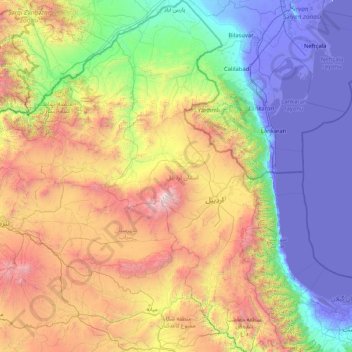
Name: Ardabil Province topographic map, elevation, terrain.
Location: Ardabil Province, Iran (37.10433 47.28717 39.70915 48.92142)
Average elevation: 1,056 m
Minimum elevation: -31 m
Maximum elevation: 4,566 m
Thank you for supporting this site ❤️
Make a donation
Make a donation