
Make a donation
Artvin Province topographic map
Click on the map to display elevation.
Make a donation
Artvin Province
Artvin is an attractive area of steep valleys carved by the Çoruh River system, surrounded by high mountains of Kaçkar, Karçal and Yalnızçam (up to 3900 m) and forest with much national parkland including the Karagöl-Sahara, which contains the Şavşat and Borçka lakes. The weather in Artvin is very wet and mild at the coast, and as a result is heavily forested. This greenery runs from the top all the way down to the Black Sea coast. The rain turns to snow at higher altitudes, and the peaks are very cold in winter.[2]
Make a donation
About this map
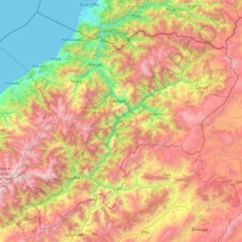
Name: Artvin Province topographic map, elevation, terrain.
Location: Artvin Province, Black Sea Region, Turkey (40.55722 41.03631 41.61200 42.59164)
Average elevation: 1,525 m
Minimum elevation: 0 m
Maximum elevation: 3,839 m
Make a donation
Other topographic maps
Click on a map to view its topography, its elevation and its terrain.