
Thank you for supporting this site ❤️
Make a donation
Make a donation
Freixo topographic map
Click on the map to display elevation.
Thank you for supporting this site ❤️
Make a donation
Make a donation
About this map
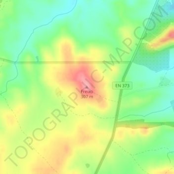
Name: Freixo topographic map, elevation, terrain.
Location: Freixo, Elvas, Portalegre, Portugal (38.96207 -7.13024 38.96217 -7.13014)
Average elevation: 250 m
Minimum elevation: 206 m
Maximum elevation: 306 m
Thank you for supporting this site ❤️
Make a donation
Make a donation