
Les Combes topographic map
Interactive map
Click on the map to display elevation.
About this map
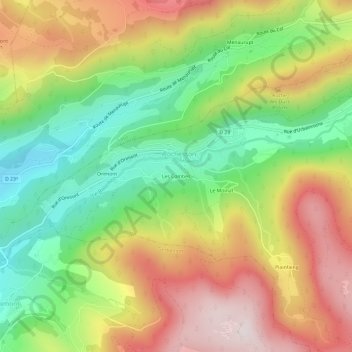
Name: Les Combes topographic map, elevation, terrain.
Average elevation: 714 m
Minimum elevation: 447 m
Maximum elevation: 1,018 m
Other topographic maps
Click on a map to view its topography, its elevation and its terrain.
Les Blanches Roches
France > Grand Est > Vosges > Rochesson
Les Blanches Roches, Rochesson, Saint-Dié-des-Vosges, Vosges, Grand Est, France métropolitaine, 88120, France
Average elevation: 827 m