
蓼城街道 topographic map
Interactive map
Click on the map to display elevation.
About this map
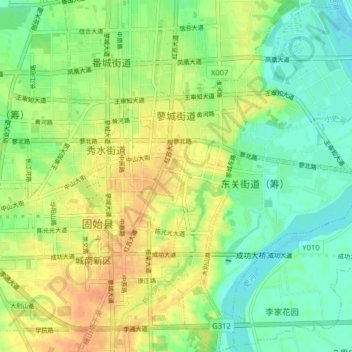
Name: 蓼城街道 topographic map, elevation, terrain.
Location: 蓼城街道, 固始县, 信阳市, 河南省, 465299, 中国 (32.14632 115.64671 32.21370 115.71426)
Average elevation: 47 m
Minimum elevation: 30 m
Maximum elevation: 66 m
Other topographic maps
Click on a map to view its topography, its elevation and its terrain.