
Thank you for supporting this site ❤️
Make a donation
Make a donation
Étangs d'Ixelles topographic map
Click on the map to display elevation.
Thank you for supporting this site ❤️
Make a donation
Make a donation
About this map
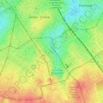
Name: Étangs d'Ixelles topographic map, elevation, terrain.
Location: Étangs d'Ixelles, Ixelles, Bruxelles-Capitale, Belgique (50.82120 4.37122 50.82692 4.37450)
Average elevation: 84 m
Minimum elevation: 53 m
Maximum elevation: 111 m
Thank you for supporting this site ❤️
Make a donation
Make a donation
Other topographic maps
Click on a map to view its topography, its elevation and its terrain.