
Petite Aiguille topographic map
Interactive map
Click on the map to display elevation.
About this map
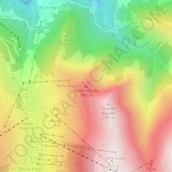
Name: Petite Aiguille topographic map, elevation, terrain.
Average elevation: 1,670 m
Minimum elevation: 1,116 m
Maximum elevation: 2,186 m
Other topographic maps
Click on a map to view its topography, its elevation and its terrain.
Grande Aiguille
Francia > Auvergne-Rhône-Alpes > Les Deux Alpes
Grande Aiguille, Les Deux Alpes, Grenoble, Isère, Auvergne-Rhône-Alpes, Francia metropolitana, 38860, Francia
Average elevation: 1,775 m
Les Perrons
Francia > Auvergne-Rhône-Alpes > Les Deux Alpes
Les Perrons, Les Deux Alpes, Grenoble, Isère, Auvergne-Rhône-Alpes, Francia metropolitana, 38860, Francia
Average elevation: 1,547 m