
Thank you for supporting this site ❤️
Make a donation
Make a donation
Ashoka Niketan topographic map
Click on the map to display elevation.
Thank you for supporting this site ❤️
Make a donation
Make a donation
About this map
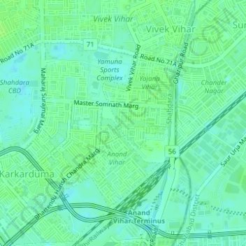
Name: Ashoka Niketan topographic map, elevation, terrain.
Location: Ashoka Niketan, Vivek Vihar Tehsil, Shahdara, Delhi, India (28.65584 77.31176 28.65965 77.31438)
Average elevation: 206 m
Minimum elevation: 201 m
Maximum elevation: 210 m
Thank you for supporting this site ❤️
Make a donation
Make a donation
Other topographic maps
Click on a map to view its topography, its elevation and its terrain.
Thank you for supporting this site ❤️
Make a donation
Make a donation
Thank you for supporting this site ❤️
Make a donation
Make a donation
Thank you for supporting this site ❤️
Make a donation
Make a donation
The Garden of Five Senses
India > Delhi > Saket Tehsil > Saidulajaib Extension
Average elevation: 242 m
Thank you for supporting this site ❤️
Make a donation
Make a donation