
Thank you for supporting this site ❤️
Make a donation
Make a donation
Neunkirchen topographic map
Click on the map to display elevation.
Thank you for supporting this site ❤️
Make a donation
Make a donation
About this map
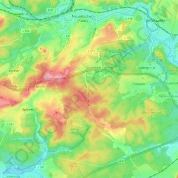
Name: Neunkirchen topographic map, elevation, terrain.
Location: Neunkirchen, Landkreis Neunkirchen, Saarland, 66538, Germany (49.28559 7.14666 49.35727 7.22243)
Average elevation: 280 m
Minimum elevation: 224 m
Maximum elevation: 367 m
Thank you for supporting this site ❤️
Make a donation
Make a donation