
雄关街道 topographic map
Interactive map
Click on the map to display elevation.
About this map
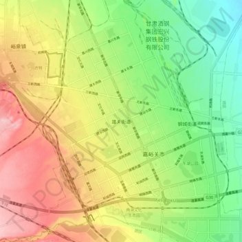
Name: 雄关街道 topographic map, elevation, terrain.
Location: 雄关街道, 嘉峪关市, 甘肃省, 735 100, 中国 (39.74296 98.23456 39.82296 98.31456)
Average elevation: 1,667 m
Minimum elevation: 1,588 m
Maximum elevation: 1,761 m