
Thank you for supporting this site ❤️
Make a donation
Make a donation
Caneças topographic map
Click on the map to display elevation.
Thank you for supporting this site ❤️
Make a donation
Make a donation
About this map
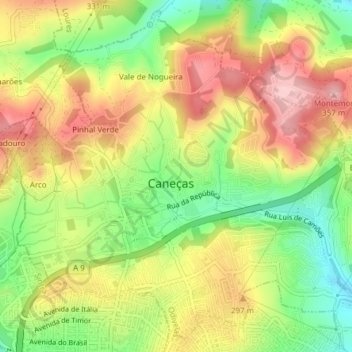
Name: Caneças topographic map, elevation, terrain.
Location: Caneças, Ramada e Caneças, Odivelas, Lisboa, Portugal (38.80262 -9.24112 38.83053 -9.20304)
Average elevation: 259 m
Minimum elevation: 162 m
Maximum elevation: 354 m
Thank you for supporting this site ❤️
Make a donation
Make a donation