
Thank you for supporting this site ❤️
Make a donation
Make a donation
Bad Rodach topographic map
Click on the map to display elevation.
Thank you for supporting this site ❤️
Make a donation
Make a donation
About this map
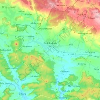
Name: Bad Rodach topographic map, elevation, terrain.
Location: Bad Rodach, Landkreis Coburg, Bavaria, 96476, Germany (50.27308 10.71232 50.39271 10.86477)
Average elevation: 352 m
Minimum elevation: 284 m
Maximum elevation: 492 m
Thank you for supporting this site ❤️
Make a donation
Make a donation
Other topographic maps
Click on a map to view its topography, its elevation and its terrain.