
Berkeley topographic map
Click on the map to display elevation.
About this map
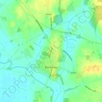
Name: Berkeley topographic map, elevation, terrain.
Location: Berkeley, Stroud, Gloucestershire, England, United Kingdom (51.68768 -2.46946 51.70364 -2.45059)
Average elevation: 15 m
Minimum elevation: 5 m
Maximum elevation: 32 m
Other topographic maps
Click on a map to view its topography, its elevation and its terrain.