
Thank you for supporting this site ❤️
Make a donation
Make a donation
Alken topographic map
Click on the map to display elevation.
Thank you for supporting this site ❤️
Make a donation
Make a donation
About this map
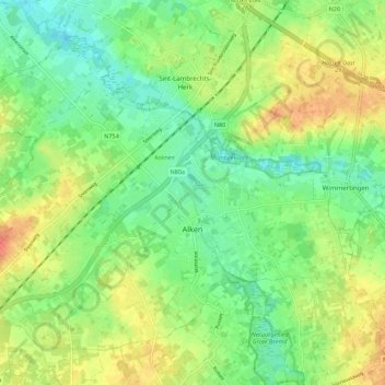
Name: Alken topographic map, elevation, terrain.
Location: Alken, Tongeren, Limburg, Flanders, Belgium (50.85367 5.24212 50.91038 5.35201)
Average elevation: 45 m
Minimum elevation: 25 m
Maximum elevation: 71 m
Thank you for supporting this site ❤️
Make a donation
Make a donation
Other topographic maps
Click on a map to view its topography, its elevation and its terrain.