
Ridgefield topographic map
Interactive map
Click on the map to display elevation.
About this map
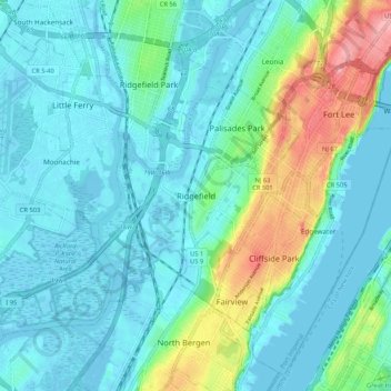
Name: Ridgefield topographic map, elevation, terrain.
Location: Ridgefield, Bergen County, New Jersey, 97657, United States (40.79427 -74.04875 40.87427 -73.96875)
Average elevation: 24 m
Minimum elevation: -4 m
Maximum elevation: 117 m